
What Santorini is known for
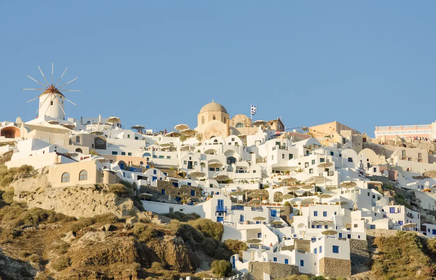
Santorini is defined by its dramatic volcanic landscape, shaped around a vast sea-filled caldera formed by one of the largest eruptions in recorded history. Whitewashed villages cling to the rim of sheer volcanic cliffs, their blue domes and cubist buildings contrasting with the deep blue waters of the southern Aegean Sea.
Travellers are drawn to the island for its sweeping caldera sunsets, striking coastline, and unique geology. Instead of standard golden sand, beaches here feature black and dark red volcanic pebbles, while the arid interior yields terraced vineyards trained into low circular baskets to withstand coastal winds.
A short history
Human settlement on the island dates to the Neolithic era. During the Bronze Age, the settlement of Akrotiri flourished as a prosperous maritime trading centre closely connected to Minoan Crete, developing multi-storey houses, paved streets, and advanced drainage systems.
In the second millennium BCE, a cataclysmic volcanic eruption tore the island apart, collapsing its centre into the sea and coating the settlements in thick pumice and ash. This preserved Akrotiri in remarkable detail, much like Pompeii nearly two millennia later.
Dorian Greeks colonized the remaining ridge around the ninth to eighth century BCE, founding the city of Ancient Thera. Later ruled by the Ptolemies, Romans, and Byzantines, the island fell under Venetian control in the thirteenth century, eventually becoming known as Santa Irini. Ottoman rule followed from the late sixteenth century until the island joined the Greek state in 1832.
A powerful earthquake struck in July 1956, causing extensive damage to cliffside villages. In the decades that followed, careful restoration and the growth of Greek tourism revived settlements such as Fira and Oia, establishing the island as an internationally recognized destination.
Neighbourhoods
Fira, the island capital, anchors the middle of the caldera rim. Its pedestrian alleys wind past whitewashed houses, small squares, and terraces opening out over the submerged volcanic crater. Walking paths lead north from Fira through Firostefani to Imerovigli, the highest clifftop village, which offers quiet stone footpaths and broad views over the craggy promontory of Skaros Rock.
At the northern tip of the island lies Oia, known for its narrow lanes, restored cave dwellings, and elegant two-storey captains' mansions that date from its days as a maritime trading hub. On the opposite side of the island, where the land slopes gently to the sea, villages like Kamari and Perissa feature wide, dark volcanic beaches backed by paved promenades, offering a distinctly relaxed coastal atmosphere.
Food and drink
Santorini's volcanic soil and dry climate give its produce an intense, concentrated flavour. Local specialities include fava, a smooth purée made from yellow split peas and finished with lemon and olive oil, and tomatokeftedes, pan-fried fritters made with sweet cherry tomatoes, onions, and fresh mint. White eggplants and capers appear across traditional menus. The island is also renowned for winemaking, particularly dry, mineral-driven white wines made from the native Assyrtiko grape and the rich, sun-dried dessert wine known as Vinsanto.
Music, arts and culture
Cultural life on the island draws from Cycladic maritime traditions and village feast days known as panigyria, where residents gather for community meals and traditional music. Architecture is central to the local heritage, featuring yposkafa, or cave homes carved directly into the soft volcanic tuff to provide natural insulation from summer heat and winter wind.
Top things to do
Walking the scenic trail along the caldera edge between Fira and Oia offers continuous views across the sea, passing through cliffside hamlets and over open volcanic ridges. South of Fira, the archaeological site of Akrotiri lets visitors walk through a covered, excavated Bronze Age city with preserved two-storey buildings, stone staircases, and ancient pottery.
High on the mountain ridge of Mesa Vouno, the windswept ruins of Ancient Thera feature stone foundations of temples, public baths, and an ancient theatre overlooking the sea. In Fira, the Museum of Prehistoric Thera houses colourful wall frescoes, pottery, and everyday items recovered from Akrotiri, while Red Beach and the black sand shores of Kamari showcase the island's striking volcanic terrain.
Day trips
Excursion boats make an easy day trip across the caldera to the uninhabited volcanic islands of Nea Kameni and Palea Kameni, where travellers can hike past steaming craters and swim near warm, mineral-rich thermal springs. Thirassia, a peaceful island that is a remnant of the ancient volcanic complex, makes another straightforward outing, offering quiet footpaths, traditional mule tracks, and simple harbours. Travellers with extra time can take an easy ferry ride to nearby islands such as Ios or Naxos.
Before you go
Confirm entry rules, ferry or air schedules, and site hours with official sources before you go, starting with the Government of Canada's Greece travel advice.
The usual mainland starting point on this site is Athens.
Best time to go
Late spring and early fall are often used for walking the caldera path without midsummer heat and crowds. July and August are the hottest and busiest. Winters are quieter, with fewer ferries and some hotel closures; wind can be strong in any month. Official ferry and bus timetables change with the season.
Getting there from Canada
Flights from Canada typically reach Santorini (Thira) via Athens, sometimes with a same-day connection in season, or by ferry from Piraeus or another island. The airport and the official port at Athinios are not in Fira itself; a transfer is required. Confirm current ferry status before you rely on a last boat.
Official travel advice
Read the Government of Canada's Greece travel advice before you go. Rules and conditions can change.
Search flights, cars, tours and airport rides under Plan your trip below. Checkout is on the partner's site.